Distritos eleitorais da Namíbia
Cada uma das 14 regiões na Namíbia são subdivididas em distritos eleitorais. O número e o tamanho de cada distrito varia com o tamanho e a população de cada região. Existem actualmente 121 distritos na Namíbia. O distrito mais populoso e o menos populoso são respetivamente a parte urbana e a parte rural da área municipal de Walvis Bay, na região do Erongo.[1]
| Namíbia |
 Este artigo é parte da série: |
|
|
|
|
· Atlas |
Conselheiros regionais são eleitos diretamente através de voto secreto (eleições regionais), pelos habitantes de cada distrito.[2]
Lista dos distritos eleitorais por região
Caprivi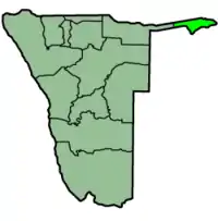 Map of Namibia with the region highlighted Kongola Linyanti Sibinda Katima Mulilo Urban Katima Mulilo Rural Kabbe |
Erongo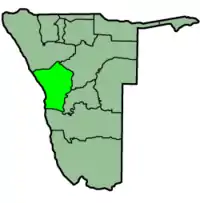 Map of Namibia with the region highlighted Omaruru Karibib Dâures Arandis Swakopmund Walvis Bay Rural Walvis Bay Urban |
Hardap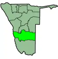 Map of Namibia with the region highlighted Gibeon Rehoboth Rural Rehoboth Urban West Rehoboth Urban East Mariental Urban Mariental Rural |
Karas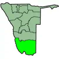 Map of Namibia with the region highlighted Berseba Lüderitz Karasburg Keetmanshoop Rural Keetmanshoop Urban Oranjemund |
Kavango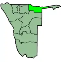 Map of Namibia with the region highlighted Kahenge Kapako Mashare Mpungu Mukwe Ndiyona Rundu Rural East Rundu Rural West Rundu Urban |
Khomas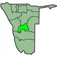 Map of Namibia with the region highlighted Katutura Central Katutura East Khomasdal North Moses //Garoëb Samora Machel John Pandeni Tobias Hainyeko Windhoek East Windhoek Rural Windhoek West |
Kunene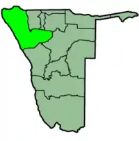 Map of Namibia with the region highlighted Epupa Opuwo Outjo Kamanjab Khorixas Sesfontein |
Omaheke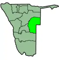 Map of Namibia with the region highlighted Aminuis Epukiro Gobabis Kalahari Otjinene Otjombinde Steinhausen |
Ohangwena Map of Namibia with the region highlighted Eenhana Endola Engela Epembe Ohangwena Okongo Omundaungilo Omulonga Ondobe Ongenga Oshikango |
Omusati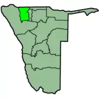 Map of Namibia with the region highlighted Anamulenge Elim Etayi Ogongo Okahao Okalongo Onesi Oshikuku Otamanzi Outapi Ruacana Tsandi |
Oshana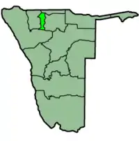 Map of Namibia with the region highlighted Okaku Okatana Okatyali Ompundja Ondangwa Ongwediva Oshakati East Oshakati West Uukwiyu Uuvudhiya |
Oshikoto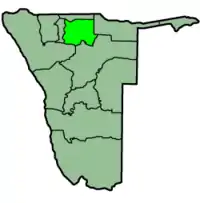 Map of Namibia with the region highlighted Eengodi Guinas Okankolo Olukonda Omuntele Omuthiyagwiipundi Onayena Oniipa Onyaanya Tsumeb |
Otjozondjupa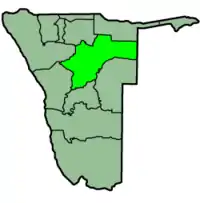 Map of Namibia with the region highlighted Grootfontein Okahandja Okakarara Omatako Otavi Otjiwarongo Tsumkwe |
Referências
- «Constituencias da Namíbia, 2004» (em inglês). Statoids.com
- «Conselho Nacional da Namíbia». União Inter-Parlamentar. Consultado em 14 de julho de 2010
This article is issued from Wikipedia. The text is licensed under Creative Commons - Attribution - Sharealike. Additional terms may apply for the media files.