Theewaterskloof
O Município de Theewaterskloof toma o seu nome da barragem de Theewaterskloof, a principal fonte de água da Cidade do Cabo, a 240 km de distância.
|
Theewaterskloof | |
| Código | WC031 |
| Superfície | 3.246 km² |
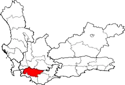
| Limites | Breede Valley (N), Breede River/Winelands (NW), Swellendam (E), Cape Agulhas (SE), Overstrand (S), Cidade do Cabo (W) e Stellenbosch (NW) |
| Presidente | Alderman C B Punt (AD) |
| Habitantes | 93.276 (29/km²) |
| Domícílios | 23.045 (7,1/km²) |
| Composição racial | mulatos 66%; negros 23%; brancos 11% |
| Línguas | afrikaans 77%; xhosa 17%; sesotho 3%; inglês 3% |
| Sítio oficial | www.twk.org.za |
Localidades
- Botrivier
- Caledon
- Genadendal
- Grabouw
- Greyton
- Riversonderend
- Tesselaarsdal
- Villiersdorp
This article is issued from Wikipedia. The text is licensed under Creative Commons - Attribution - Sharealike. Additional terms may apply for the media files.