| Colinroobie New South Wales | |
|---|---|
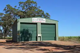 Rural Fire Service shed | |
  Colinroobie | |
| Coordinates | 34°32′19″S 146°35′36″E / 34.53861°S 146.59333°E |
| Population | 51 (SAL 2021)[1] |
| Postcode(s) | 2700 |
| Elevation | 291 m (955 ft) |
| Location |
|
| LGA(s) | Narrandera Shire |
| County | Cooper |
| State electorate(s) | Cootamundra |
| Federal division(s) | Riverina |
Colinroobie is a rural community in the central part of the Riverina in southern New South Wales, Australia. Previously referred to as Bents Hill its name was changed in January 2005.[3]
It is situated by road, about 33 kilometres (21 mi) north of Narrandera and 27 kilometres (17 mi) south of Barellan.
Colinroobie Post Office opened on 5 November 1895 and closed in 1952.[4]
Notes and references
- ↑ Australian Bureau of Statistics (28 June 2022). "Colinroobie (suburb and locality)". Australian Census 2021 QuickStats. Retrieved 28 June 2022.
- ↑ Travelmate Archived 24 March 2007 at the Wayback Machine
- ↑ "Colinroobie". Geographical Names Register (GNR) of NSW. Geographical Names Board of New South Wales.
- ↑ Phoenix Auctions History, Post Office List, retrieved 26 March 2021
External links
 Media related to Colinroobie at Wikimedia Commons

This article is issued from Wikipedia. The text is licensed under Creative Commons - Attribution - Sharealike. Additional terms may apply for the media files.