39°41′24″N 22°04′40″E / 39.690058°N 22.077777°E
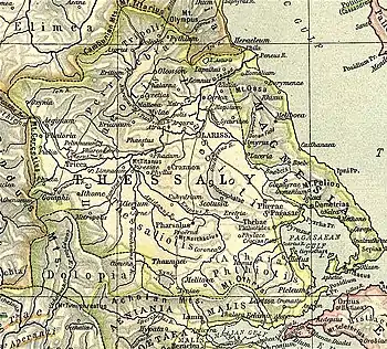
Ericinium or Ereikinion (Ancient Greek: Ἐρεικίνιον) was a town and polis (city-state) of Perrhaebia in ancient Thessaly,[1] situated near the frontiers of Histiaeotis.[2]
The existence of the town is attested by epigraphic evidence at least since the 4th century BCE.[1] In the Roman-Seleucid War, in the year 191 BCE, it was taken from the Athamanians by the joint army commanded by the Roman Marcus Baebius Tamphilus and Philip V of Macedon.[3]
Its location has been found at the modern village of Megalo Eleftherochori.[1][4][5]
References
- 1 2 3 Mogens Herman Hansen & Thomas Heine Nielsen (2004). "Thessaly and Adjacent Regions". An inventory of archaic and classical poleis. New York: Oxford University Press. p. 723. ISBN 0-19-814099-1.
- ↑ Livy. Ab urbe condita Libri [History of Rome]. Vol. 36.13, 39.25.
- ↑ Livy. Ab urbe condita Libri [History of Rome]. Vol. 36.13.
- ↑ Richard Talbert, ed. (2000). Barrington Atlas of the Greek and Roman World. Princeton University Press. p. 55, and directory notes accompanying.
- ↑ Lund University. Digital Atlas of the Roman Empire.
 This article incorporates text from a publication now in the public domain: Smith, William, ed. (1870). "Ericinium". Dictionary of Greek and Roman Antiquities. London: John Murray.