| Mali River Mali Hka | |
|---|---|
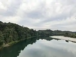 Mali Hka near Machanbaw | |
 | |
| Location | |
| Country | Myanmar |
| Physical characteristics | |
| Source | |
| • location | Kachin Hills |
| Mouth | |
• location | Confluence with the N'Mai River |
• coordinates | 25°42′37″N 97°30′10″E / 25.71028°N 97.50278°E |
• elevation | 150 m (490 ft) |
| Length | 320 kilometres (200 mi) |
| Basin size | 23,220.8 km2 (8,965.6 sq mi)[1] |
| Discharge | |
| • average | 2,693.3 m3/s (95,110 cu ft/s)[1] |
| Basin features | |
| River system | Ayeyarwady |
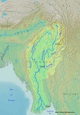
The Mali River (Mali Hka) is a river that originates in the hills of Kachin State, in the northern border of Myanmar. It flows approximately 320 km, when it meets with the N'Mai River and forms the Ayeyarwady River.
History
Construction of the Myitsone Dam has begun at the confluence of the Mali and the N'Mai River.[2]
See also
References
This article is issued from Wikipedia. The text is licensed under Creative Commons - Attribution - Sharealike. Additional terms may apply for the media files.