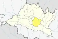
Temal (RM)
तेमाल गाउँपालिका | |
|---|---|
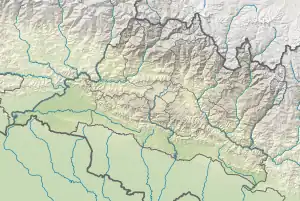  Temal (RM) Location 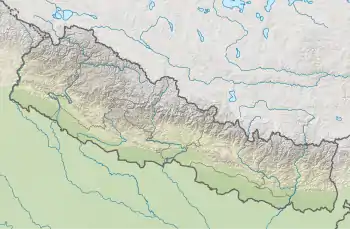 Temal (RM) Temal (RM) (Nepal) | |
| Coordinates: 27°31′N 85°44′E / 27.52°N 85.74°E | |
| Country |  Nepal Nepal |
| Province | Bagmati |
| District | Kavrepalanchowk |
| Wards | 9 |
| Established | 10 March 2017 |
| Government | |
| • Type | Rural Council |
| • Chairperson | Mr. Chandra Bahadur Tamang |
| • Vice-chairperson | Mr. Dal Man Thokar |
| Area | |
| • Total | 89 km2 (34 sq mi) |
| Population (2011) | |
| • Total | 22,712 |
| • Density | 260/km2 (660/sq mi) |
| Time zone | UTC+5:45 (Nepal Standard Time) |
| Headquarter | Pokhari Narayansthan |
| Website | temalmun |
Temal is a Rural municipality located within the Kavrepalanchowk District of the Bagmati Province of Nepal. The municipality spans 89 square kilometres (34 sq mi) of area, with a total population of 22,712 according to a 2011 Nepal census.[1][2]
On March 10, 2017, the Government of Nepal restructured the local level bodies into 753 new local level structures.[3][4] The previous Sarasyunkhark, Saramthali, Bolde Fediche, Pokhari Narayansthan, Thulo Parsel Kuruwas Chapakhori and Milche VDCs were merged to form Temal Rural Municipality. Temal is divided into 9 wards, with Pokhari Narayansthan declared the administrative center of the rural municipality.
Demographics
At the time of the 2011 Nepal census, Temal Rural Municipality had a population of 22,712. Of these, 73.1% spoke Tamang, 21.6% Nepali, 3.5% Newar, 0.9% Magar, 0.7% Majhi, 0.1% Maithili and 0.1% other languages as their first language.[5]
In terms of ethnicity/caste, 73.1% were Tamang, 7.3% Hill Brahmin, 5.7% Magar, 4.2% Chhetri, 3.7% Newar, 2.6% Kami, 1.4% Damai/Dholi, 0.8% Majhi, 0.6% Thakuri, 0.1% Gharti/Bhujel, 0.1% Sonar and 0.3% others.[6]
In terms of religion, 73.9% were Buddhist, 25.3% Hindu, 0.3% Prakriti, 0.2% Christian and 0.4% others.[7]
In terms of literacy, 64.3% could read, 2.7% could only read and 32.9% could neither read nor write.[8]
References
- ↑ "District Corrected Last for RAJAPATRA" (PDF). www.mofald.gov.np. Retrieved 17 July 2018.
- ↑ "स्थानीय तहहरुको विवरण" [Details of the local level bodies]. www.mofald.gov.np/en (in Nepali). Ministry of Federal Affairs and Local Development. Retrieved 17 July 2018.
- ↑ "New local level structure comes into effect from today". www.thehimalayantimes.com. The Himalayan Times. 10 March 2017. Retrieved 17 July 2018.
- ↑ "New local level units come into existence". www.kathmandupost.ekantipur.com. 11 March 2017. Retrieved 18 July 2018.
- ↑ NepalMap Language
- ↑ NepalMap Caste
- ↑ NepalMap Religion
- ↑ NepalMap Literacy
External links