| The Cabox | |
|---|---|
 | |
| Highest point | |
| Elevation | 812 m (2,664 ft) |
| Prominence | 812 m (2,664 ft) |
| Listing | |
| Coordinates | 48°49′59″N 58°29′03″W / 48.83306°N 58.48417°W |
| Geography | |
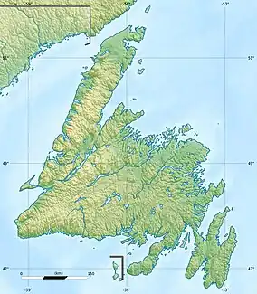  The Cabox | |
| Parent range | Long Range Mountains |
| Topo map | NTS 12B16 Georges Lake |
| Climbing | |
| First ascent | William Seaward (1832) |
| Easiest route | class 2 scramble |
The Cabox is the highest mountain on the island of Newfoundland, located on the western part of the island near the coastal town of Stephenville.[1] It is 812 m (2,664 ft) high and the central peak of the Lewis Hills of the Long Range Mountains, which are a subrange in the Appalachian Mountains.
See also
References
This article is issued from Wikipedia. The text is licensed under Creative Commons - Attribution - Sharealike. Additional terms may apply for the media files.