| Upper Broughton | |
|---|---|
 | |
  Upper Broughton Location within Nottinghamshire | |
| Area | 0.2275 km2 (0.0878 sq mi) |
| Population | 327 (2011 census) |
| • Density | 1,437/km2 (3,720/sq mi) |
| Civil parish |
|
| District | |
| Shire county | |
| Region | |
| Country | England |
| Sovereign state | United Kingdom |
| Post town | Melton Mowbray |
| Postcode district | LE14 |
| UK Parliament | |
| Website | http://upperbroughton.objectis.net/ |
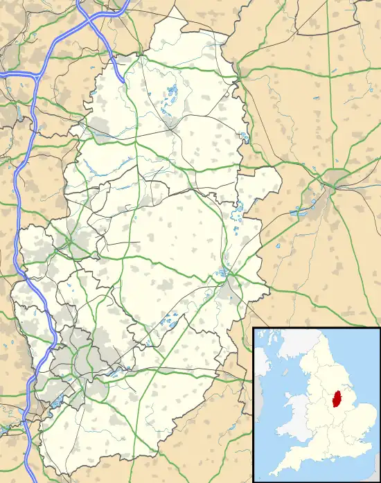
Upper Broughton or Broughton-Sulney or Over-Broughton[1] is a village and civil parish about seven miles north west of Melton Mowbray,[2] in the Rushcliffe district of the county of Nottinghamshire, England. In 2011 the built-up area had a population of 327,[3] the same as the parish.[4] The parish touches Wymeswold, Hickling, Widmerpool, Broughton and Old Dalby and Willoughby on the Wolds.[5] Upper Broughton is a conservation area that was designated in 1973 and is 16 hectares.[6] It is near the boundary with Leicestershire,[7] and Nether Broughton is across the county boundary.
Features
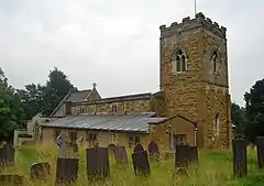
There are 16 listed buildings in Upper Broughton,[8] of which St Luke's Church is Grade I listed.[9]
Upper Broughton has a village hall, on Melton Road (A606) near the junction with Bottom Green.[10]
For many years there was a pub on Main Street, originally called the Golden Fleece and latterly the Tap and Run co-owned by Stuart Broad and Harry Gurney, but this was badly damaged by fire in June 2022.[11][12]
Upper Broughton railway station opened in 1880 and closed in 1948.[13]
History
The name "Broughton" means 'Farm by the brook'.[14] Upper Broughton was recorded in the Domesday Book as Brotone.[15] On the 1st of April 1965 an area of Broughton and Old Dalby parish was transferred to the parish. The transferred area was 21 acres.[16] The parish was part of the Bingham Wapentake.[17] "Broughton Sulney" is another name for the parish.[18]
References
- ↑ "Broughton Sulney". GENUKI. Retrieved 10 May 2019.
- ↑ "History of Upper Broughton, in Rushcliffe and Nottinghamshire". A Vision of Britain through Time. Retrieved 10 May 2019.
- ↑ UK Census (2011). "Local Area Report – Upper Broughton Built-up area (E34001043)". Nomis. Office for National Statistics. Retrieved 10 May 2019.
- ↑ UK Census (2011). "Local Area Report – Upper Broughton Parish (E04008011)". Nomis. Office for National Statistics. Retrieved 10 May 2019.
- ↑ "Upper Broughton". Ordnance Survey. Retrieved 10 May 2019.
- ↑ "Upper Broughton". Rushcliffe Borough Council. Retrieved 10 May 2019.
- ↑ "Broughton Sulney Description and Travel". GENUKI. Retrieved 10 May 2019.
- ↑ "Listed Buildings in Upper Broughton, Rushcliffe, Nottinghamshire". British Listed Buildings. Retrieved 10 May 2019.
- ↑ Historic England, "Church of St Luke (319538)", Research records (formerly PastScape), retrieved 10 May 2019
- ↑ "Upper Broughton Village Hall". Upper Broughton. Retrieved 10 May 2019.
- ↑ "Tap & Run pub owned by Stuart Broad badly damaged in Nottinghamshire village fire". Nottinghamshire Live. Nottingham Post. Retrieved 14 June 2022.
- ↑ Fire-hit Tap & Run pub expected to be closed until at least spring 2023 Nottinghamshire Live, 21 June 2022. Retrieved 8 July 2022
- ↑ Historic England, "Upper Broughton station (509150)", Research records (formerly PastScape), retrieved 10 May 2019
- ↑ "Upper Broughton Key to English Place-names". The University of Nottingham. Retrieved 10 May 2019.
- ↑ "Nottinghamshire S-Z". The Domesday Book Online. Retrieved 10 May 2019.
- ↑ "Relationships and Changes Upper Broughton AP/CP through time". A Vision of Britain through Time. Retrieved 10 May 2019.
- ↑ "Broughton Sulney Politics and Government". GENUKI. Retrieved 10 May 2019.
- ↑ "Broughton Sulney Names, Geographical". GENUKI. Retrieved 10 May 2019.
External links

- "Parishes: Upper or Over Broughton". British History Online. Retrieved 10 May 2019.