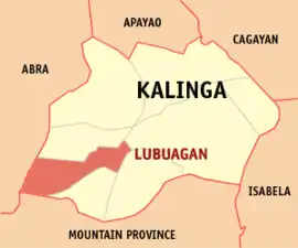
Lubuagan
Lubuagan é um município de quarta classe de renda municipal (d) na província Kalinga, nas Filipinas. De acordo com o censo de possui uma população de 9 323 pessoas[3] e 1 982 domicílios.[4]
| ||
|---|---|---|
| Município | ||
 | ||
| Localização | ||
 Coordenadas : 17°21'N, 121°11'E | ||
| País | ||
| Região | Região Administrativa de Cordillera (CAR) | |
| Província | Kalinga | |
| História | ||
| Dia da fundação | ||
| Administração | ||
| Eleitorado | 10 344[1] | |
| Características geográficas | ||
| Área total | 234,2 km2 km² | |
| População total () | 9 323 hab. | |
| • Domicílios | 1 982 | |
| Economia | ||
| • Classe de renda | quarta classe de renda municipal (d) | |
| • Incidência de pobreza | 20,23% (2018)[2] | |
| • Renda | 99 431 667,34 peso filipino | |
| • Ativos | 251 328 594,93 peso filipino | |
| • Passivos | 59 199 056,51 peso filipino | |
| Códigos | ||
| Altitude | 820 m m | |
| Fuso horário | Hora Padrão das Filipinas (UTC+8) | |
| Código postal | 3802 | |
| Código de área | 74 | |
| Outras informações | ||
| Tipo de clima | clima equatorial | |
| PSGC | 143206000 | |
| Línguas nativas | Kalinga (en), Ilocano e língua tagalo | |
| Sítio | www.lubuagan.gov.ph | |
Demografia
| Evolução da população de Lubuagan | ||
|---|---|---|
| Ano | Pop. | ±% p.a. |
| 1918 | 8 874 | — |
| 1939 | 7 366 | −0.88% |
| 1948 | 7 821 | +0.67% |
| 1960 | 10 289 | +2.31% |
| 1970 | 7 236 | −3.45% |
| 1975 | 7 780 | +1.46% |
| 1980 | 8 545 | +1.89% |
| 1990 | 9 189 | +0.73% |
| 1995 | 9 897 | +1.40% |
| 2000 | 9 875 | −0.05% |
| 2007 | 10 183 | +0.42% |
| 2010 | 9 369 | −2.99% |
| 2015 | 8 733 | −1.33% |
| 2020 | 9 323 | +1.29% |
| Fonte: PSA [3][5][6][7] | ||
Referências
- «Number and Turn-Out of Registered Voters and Voters Who Actually Voted by City/Municipality May 9, 2022 National and Local Elections». 5 agosto 2022. Cópia arquivada em
|arquivourl=requer|arquivodata=(ajuda) 🔗 - «PSA Releases the 2018 Municipal and City Level Poverty Estimates». Autoridade de Estatística das Filipinas. 15 dezembro 2021. Consultado em 22 janeiro 2022
- Census of Population (2015). «Cordillera Administrative Region (CAR)». Total Population by Province, City, Municipality and Barangay (em inglês). Filipinas: PSA. Consultado em 20 de junho de 2016
- «Household Population, Number of Households, and Average Household Size of the Philippines (2020 Census of Population and Housing)». Autoridade de Estatística das Filipinas. 23 março 2022. Consultado em 1 abril 2022
- Census of Population and Housing (2010). «Cordillera Administrative Region (CAR)». Total Population by Province, City, Municipality and Barangay (em inglês). Filipinas: NSO. Consultado em 29 de junho de 2016
- Census of Population (1995, 2000 and 2007). «Cordillera Administrative Region (CAR)». Total Population by Province, City and Municipality (em inglês). Filipinas: NSO. Cópia arquivada em 24 de junho de 2011
- Municipality Population Data. Local Water Utilities Administration Research Division, ed. «Província de Kalinga» (em inglês). Consultado em 17 de dezembro de 2016
Ligações externas
- PhilAtlas.com
- Código Geográfico Padrão Filipino
- Sistema de gestão de desempenho de governança local
- www
.lubuagan .gov .ph
Tabuk (capital) | |
| Municípios das Filipinas | |
| Cidade componente | |
This article is issued from Wikipedia. The text is licensed under Creative Commons - Attribution - Sharealike. Additional terms may apply for the media files.