Okharkot
ओखरकोट khahare | |
|---|---|
RM Development Committee | |
| Nickname: jhimruk | |
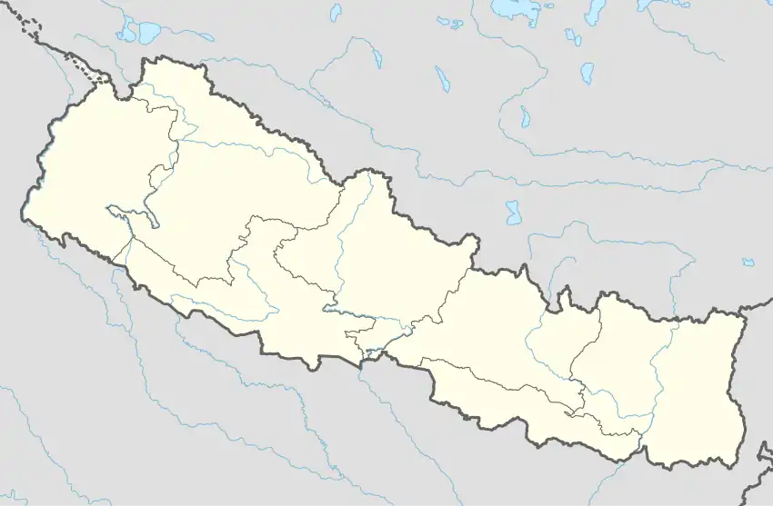  Okharkot Location in Nepal | |
| Coordinates: 28°08′N 82°59′E / 28.14°N 82.98°E | |
| Country |  Nepal Nepal |
| Development Region | Mid-Western |
| Zone | Rapti Zone |
| District | Pyuthan District |
| VDC | Okharkot |
| Population (2001 Census[1]) | |
| • Total | 4,484 |
| 836 households | |
| Time zone | UTC+5:45 (Nepal Time) |
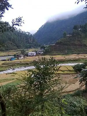
Machcchi Village, administrative center of Okharkot VDC with Gartang Khola in the foreground
Okharkot is a town and Village Development Committee in Pyuthan, a Middle Hills district of Rapti Zone, western Nepal.
Etymology
Okhar (Nepali: ओखर) - walnut tree (Juglans regia).
kot (Nepali: कोट) - guardroom, prison, police station.
Villages in this VDC
| Ward | Lat. | Lon | Elev. | ||
|---|---|---|---|---|---|
| Ahal | आहाल | 6 | 28°10'N | 83°00'E | 1,089m |
| Aphrekholagaun | आफ्रेखोलागाउँ | 28°09'N | 82°59'E | 1,205 | |
| Arupata | आरुपाटा | 28°09'N | 82°59'E | 1,045 | |
| Badikholagaun | बादीखोलागाउँ | 28°09'N | 82°59'E | 1,210 | |
| Banstari | बाँसटारी | 28°08'N | 82°58'E | 1,205 | |
| Bebare | बेबरे | 28°10'N | 83°00'E | 1,590 | |
| Bhedabari | भेडाबारी | 28°10'N | 83°00'E | 1,255 | |
| Chauke | चौके | 9 | 28°07'N | 82°58'E | 1,542 |
| Chichinne | चिचिन्ने | 28°07'N | 82°57'E | 1,710 | |
| Chudhara | चुधारा | 8 | 28°08'N | 82°58'E | 1,110 |
| Darimchaur | दारिमचौर | 6 | 28°09'N | 82°59'E | 1,030 |
| Dhana | ढाँणा | 28°09'N | 82°58'E | 1,050 | |
| Dhana Bajar | ढाँडाबजार | 28°09'N | 82°58'E | 995 | |
| Hariya | हरिया | 28°10'N | 82°59'E | 1,170 | |
| Kalleri | कल्लेरी | 28°08'N | 82°59'E | 1,597 | |
| Kamdale | कमडाले | 28°07'N | 82°58'E | 1,642 | |
| Kami Tol | कामी टोल | 28°08'N | 83°00'E | 1,475 | |
| Khahare | खहरे | 28°08'N | 82°59'E | 1,030 | |
| Koiralpata | कोइरलपाटा | 28°09'N | 82°59'E | 1,090 | |
| Kubinde | कुबिण्डे | 28°07'N | 82°58'E | 1,470 | |
| Lamasera | लामासेरा | 28°10'N | 82°59'E | 1,018 | |
| Machchhi | मच्छी | 1 | 28°08'N | 82°58'E | 955 |
| Okharkot | ओखरकोट | 28°08'N | 82°59'E | 1,630 | |
| Ratamata | रातामाटा | 28°08'N | 83°00'E | 1,538 | |
| Ripapakha | रिपापाखा | 7 | 28°08'N | 82°58'E | 1,045 |
| Rotepani | रोटेपानी | 28°09'N | 82°59'E | 1,170 | |
| Salleri | सल्लेरी | 28°08'N | 82°58'E | 1,610 | |
| Samaldhara | समलधारा | 28°10'N | 82°59'E | 1,418 | |
| Sisnekholagaun | सिस्नेखोलागाउँ | 28°09'N | 83°00'E | 1,285 | |
| Swanbota | स्वाँबोटा | 28°08'N | 82°58'E | 955 | |
| Tada Pokhari | टाडा पोखरी | 28°08'N | 82°58'E | 1,285 | |
| Tari | टारी | 28°07'N | 82°59'E | 1,285 | |
| Tilahalna | तिलाहाल्ना | 7 | 28°08'N | 82°57'E | 955 |
Machcchī is the VDC's administrative center at the confluence of Dharmawati River and Gartang Khola. Okharkot village with its ancient fortress sits on a ridgetop 2 km. east and some 675 meters (2200 feet) higher. It is listed in IUCN's inventory of historic sites.[3]
References
- ↑ "Nepal Census 2001". Nepal's Village Development Committees. Digital Himalaya. Archived from the original on October 12, 2008. Retrieved 21 September 2008.
- ↑ "Index of Geographical Names of Nepal, Volume IV: Mid Western Development Region, List of Settlements, Pyuthan" (PDF). Government of Nepal, National Geographic Information Infrastructure Program. Archived from the original (PDF) on July 24, 2011. Retrieved 2011-03-12.
- ↑ Bhandari, Bishnu, ed. (1997). Inventory of heritage sites in Nepal. Kathmandu: IUCN Nepal. Archived from the original on July 21, 2011. Retrieved April 15, 2011.
External links
This article is issued from Wikipedia. The text is licensed under Creative Commons - Attribution - Sharealike. Additional terms may apply for the media files.